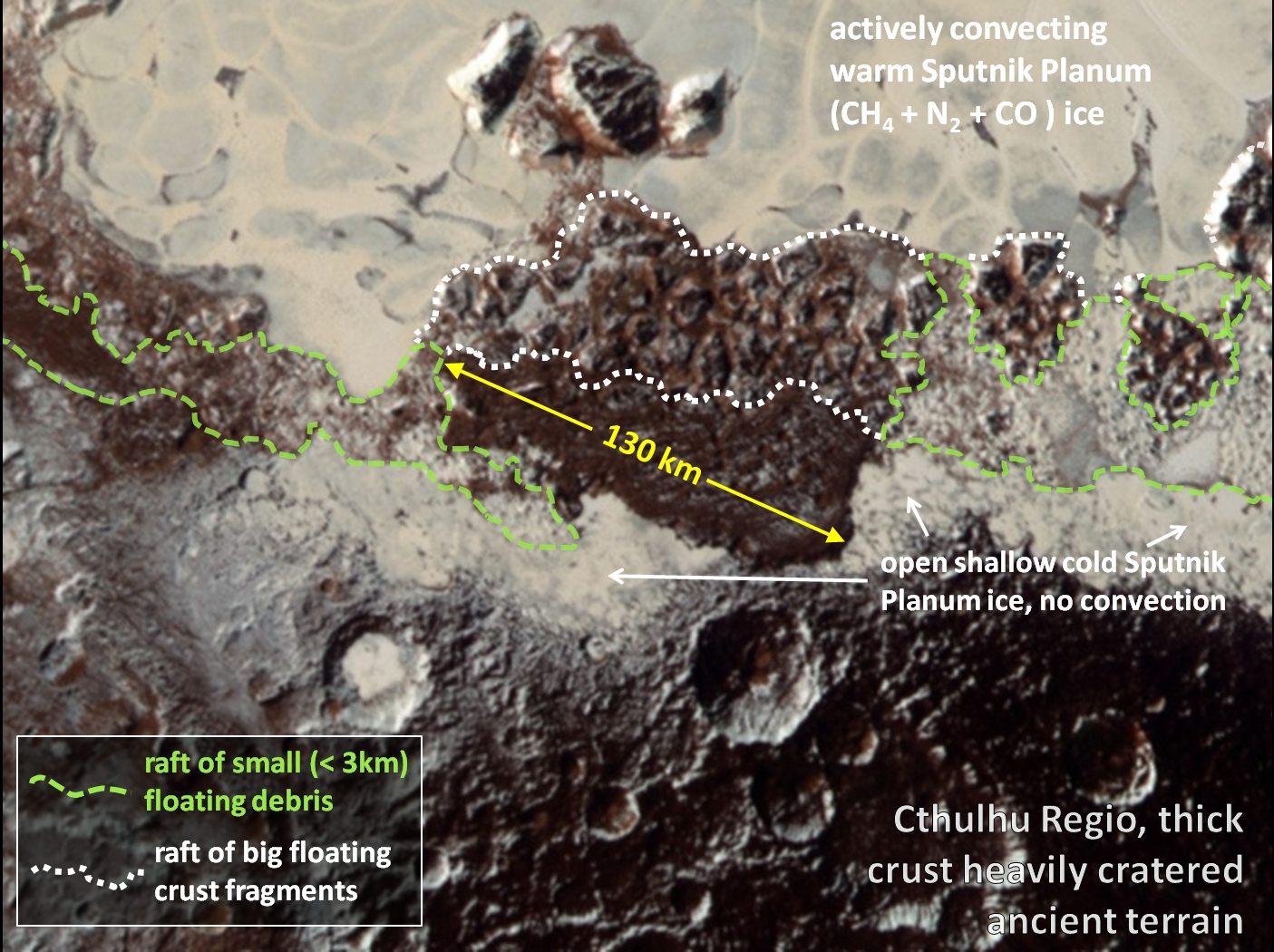
The jagged mountain ranges along Sputnik Planum’s western shore, from al-Idrisi Montes to Norgay Montes, are made of fragments of Pluto’s crust. A section of crust was shattered and the pieces were washed up on the shore by an icy tsunami.
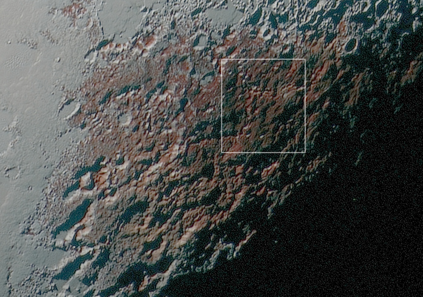
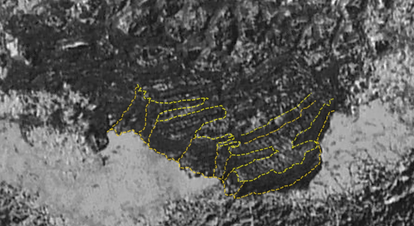
At first sight Baré Montes looks quite similar to the ‘chaos terrain’ of the al-Idrisi Montes, where 10 km ~ 20 km sized blocks that have washed up against the shore form a raft. This is true, at least for the ‘seaward’ half of Baré Montes (‘seaward’ since Sputnik Planum is an ice sea). The shore-ward half of Baré Montes has attracted a lot of attention because it is covered with parallel ridges that give the impression of a dune field. So far we have not gotten a close enough look to identify any other ‘dune fields’ like this elsewhere on Pluto.
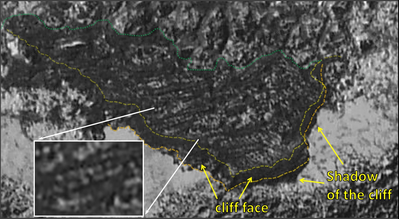
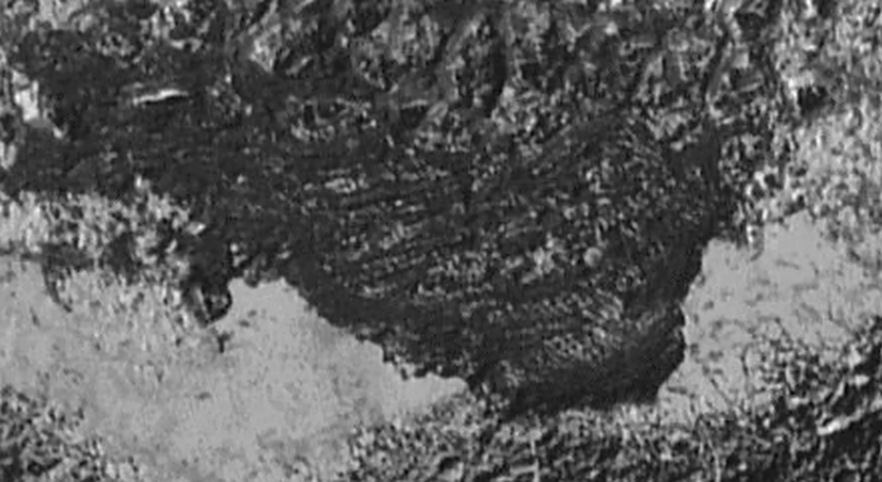
The surface texture of this piece of territory is quite different to the heavily cratered ancient Cthulhu Regio immediately to its west, making it look strangely out of place. The juxtaposition of different textures is confusing until you see the shadow at the southern end (to the right in the image above) that reveals an enormous cliff around it. It looks out of place because it is out of place. This is another slab of crust broken out its original location and washed up on the shore of Cthulhu Regio just like the smaller slabs.
This giant beached iceberg is 130 km wide, although it is probably not primarily made of water or any other kind of ice so ‘crust-berg’ is probably a more apt description. The cliff has a fairly uniform height of at least ~ 6 km. Making it thicker than the 5 km thick slabs of al-Idrisi Montes.
The 130 km long crust-berg preserves a sample of the surface of Sputnik Planum from before the cataclysm that shattered it and flooded the surrounding terrain. The surfaces of other smaller crust-bergs (up to 40 km across) have been scrubbed clean by the tumult of the ice tsunami that carried them to the western shore of Sputnik Planum.
A few of the al-Idrisi Montes blocks and Baré Montes seaward blocks show linear markings that might be the remnants of more complex surface texture like that of this 130 km slab. The rest show simple angular facets, so they are probably floating upside down. It is likely that all of these smaller (but still huge) blocks have tumbled over more than once.
Only the 130 km crust-berg of Baré Montes was big enough to resist capsizing. Since it floated on top of the ice floods its surface texture remained intact. We might expect to find the same kind of surface texture around the shores of Sputnik Planum but they too have been scoured by ice floods, with the exception of the western-most extreme of Krun Regio, lying between the eastern and southern lobes of Tombaugh Regio.
For Baré Montes the resolution of the black and white LORRI image is better than of the 8000 x 8000 pixel full disk color montage so far released. The level of contrast in the color montage is lower a circular feature in the shallow ice near the beach can be seen to continue into the shadow, confirming that the shadow is just that. When the LORRI image is magnified sufficiently to see details of Baré Montes ‘checkerboard’ artifacts of the imaging process become visible and tend to distract the eye from the actual structure on Pluto. I applied just enough blurring to the image to remove the distraction.
The high resolution image of al-Idrisi Montes released on September 24 demonstrated the difficulty of interpreting images with low resolutions. A dark area in the lee of a slanting block that looked like a shadow in the low resolution image turned out to be a deposit of dark red dust in the high resolution image.
The detailed structure of Baré Montes is right at the limit of the resolution of the images. It is difficult to identify the top of the cliff along the western side of the slab (to the left in the image) due to the oblique viewing angle and the fact that both the slab top and the western cliff face are fairly equally illuminated. The more I study the image the more alternate, more complex outlines for the cliff edge suggest themselves. If the near horizontal parallel lines are interpreted as the edges of strata within the slab then the fact that in places they lie at slightly different angles to each other and follow curves in other places, brings a more fractured and craggy structure into focus.
Even if this more complex structure is closer to reality it doesn’t change the conclusion that this 130 km slab of crust was transported to this beach by an ice flood. It is still at least 6 km high, still monolithic and still out of place. The only alternative interpretation would be that this mesa was present before the flood and therefore that at some point in Pluto’s history a 6 km thick layer was removed from the entirety of Cthulhu Regio except here. Given the location of the 130 km slab on Sputnik Planum’s beach that interpretation seems unlikely to be the right one.
Still there is the mystery of why the 130 km slab looks so different to the smaller blocks if they all have similar origins. I can see 2 possibilities, one is that the smaller ( < 40 km ) blocks have all been ‘painted’ white by whatever minor component of Sputnik Planum ice it is that is left behind after the volatile components, like methane, nitrogen and carbon monoxide, have evaporated and forms a white coat over the eastern and southern lobes of Tombaugh Planum, as well as the rafts of small debris that link the collections of bigger pieces (the “Montes”) together. In this case the blocks smaller than 40 km would look a lot more like the 130 km slab underneath the ‘paint’. The other possibility is that the 130 km slab has a thick base layer of material like that of the blocks smaller than 40 km with more complex but delicate structures like the ‘pipes’ on top. So when a big section of crust like the 130 km slab breaks up and the pieces tumble over, all that survives is the tough base sections.
